Aerial LiDAR mapping for Houston job sites.

LiDAR mapping, reality capture, and inspection for construction, utility, rail, and industrial teams. Survey-grade accuracy, 1–3 cm when the project demands it.

From LiDAR capture to cloud-ready deliverables.

Capture once. Deliver every format your team needs.

Axis Geospatial transforms aerial, mobile, and SLAM LiDAR into engineering-ready deliverables for construction, utility, rail, and industrial projects. High-density point clouds, terrain models, and digital twins that export straight into the CAD, BIM, and GIS tools your team already runs: .dwg, .rcp, .las, and more.
Common deliverables
Point clouds
.LAS · .LAZ · .E57 · classified
Terrain & surfaces
DSM / DTM · contours · cross-sections
Volumetrics
cut / fill · stockpile reports
Models & exports
digital twins · BIM · CAD / GIS · 360°
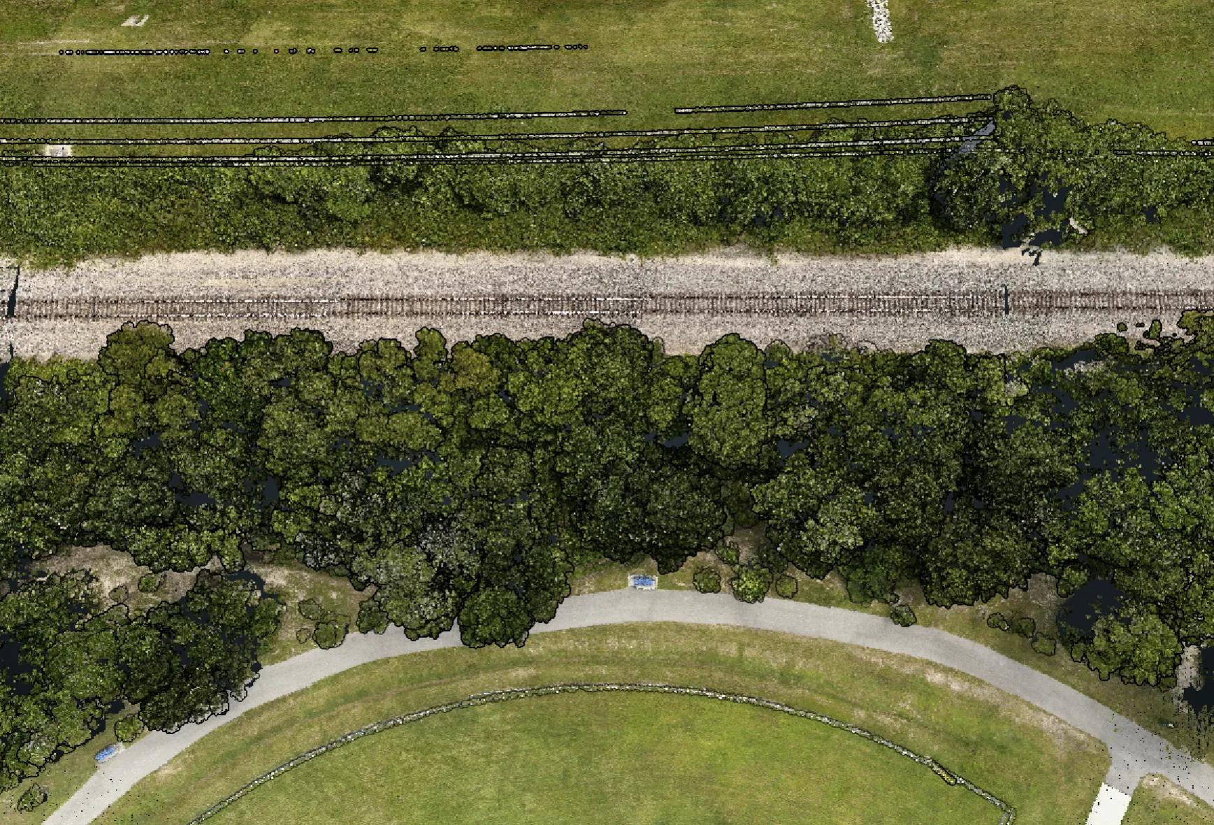
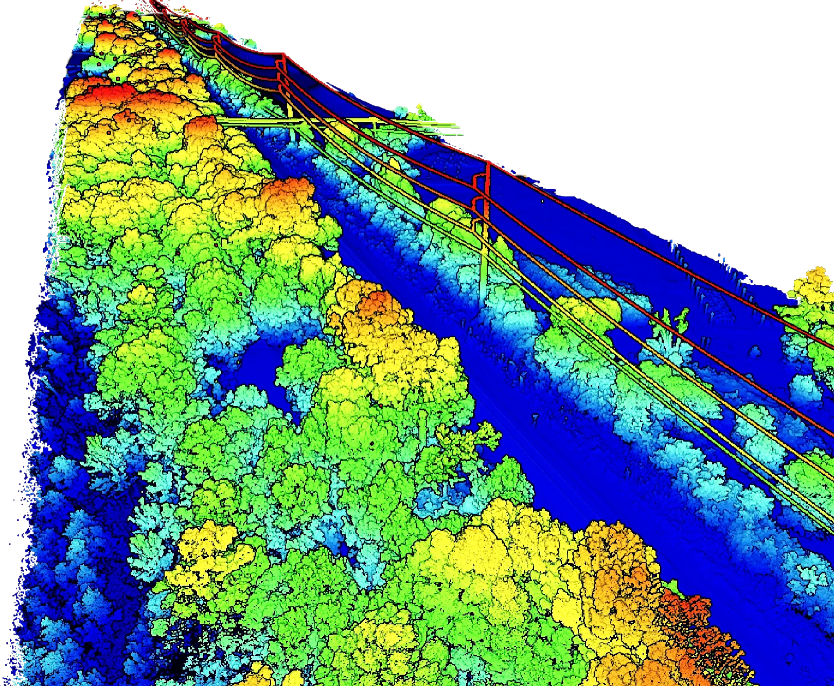
Colorized aerial LiDAR point cloud of a railway corridor: dense height-shaded tree canopy ramped from blue through green and yellow to red, flanked by overhead catenary conductors receding along the tracks.

Scoped around the decision you need to make.

Construction, utility, rail, and industrial teams each start from a different question. Axis scopes the flight and deliverables around the call you need to make, not a fixed package.
LAND DEVELOPMENT
Read the terrain, drainage, and cut/fill of a raw site before you commit to a plan.
terrain
CIVIL ENGINEERING
Get existing conditions and surfaces that drop straight into the design file.
surfaces
CONSTRUCTION
Track earthwork volumes, document progress, and compare each phase against plan.
volumes
ROOFING
Find trapped moisture under the membrane before deciding to repair or replace.
thermal
INDUSTRIAL & UTILITY
Capture facilities, corridors, and hard-to-reach assets without pausing operations.
assets
RAIL & TRANSIT
Survey ballast, track geometry, and right-of-way without taking the track out of service.
corridor
Who we serve, by industry
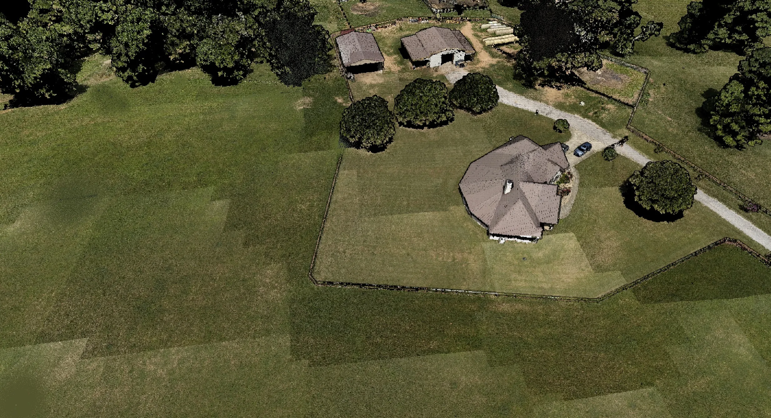
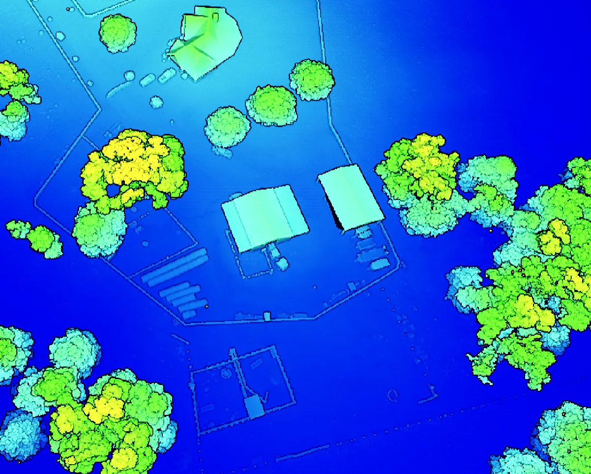
Colorized aerial LiDAR point cloud of a residential property, classified by height: blue ground and hardscape, cyan outbuildings, and tree canopy ramped from green through yellow.

A clear path from site request to usable files.

  1. 01

    Scope

    Confirm location, acreage, access, deliverables, and project timeline.

  2. 02

    Plan

    Review airspace, site constraints, safety considerations, and capture method.

  3. 03

    Capture

    Fly repeatable mission patterns for mapping and inspection.

  4. 04

    Process

    Convert imagery into client-ready maps, models, and reports.

  5. 05

    Deliver

    Package files for owners, engineers, builders, and project managers.

// recent projects

Real captures, real clients.

LiDAR & aerial capture · delivered via Rock Robotic Cloud

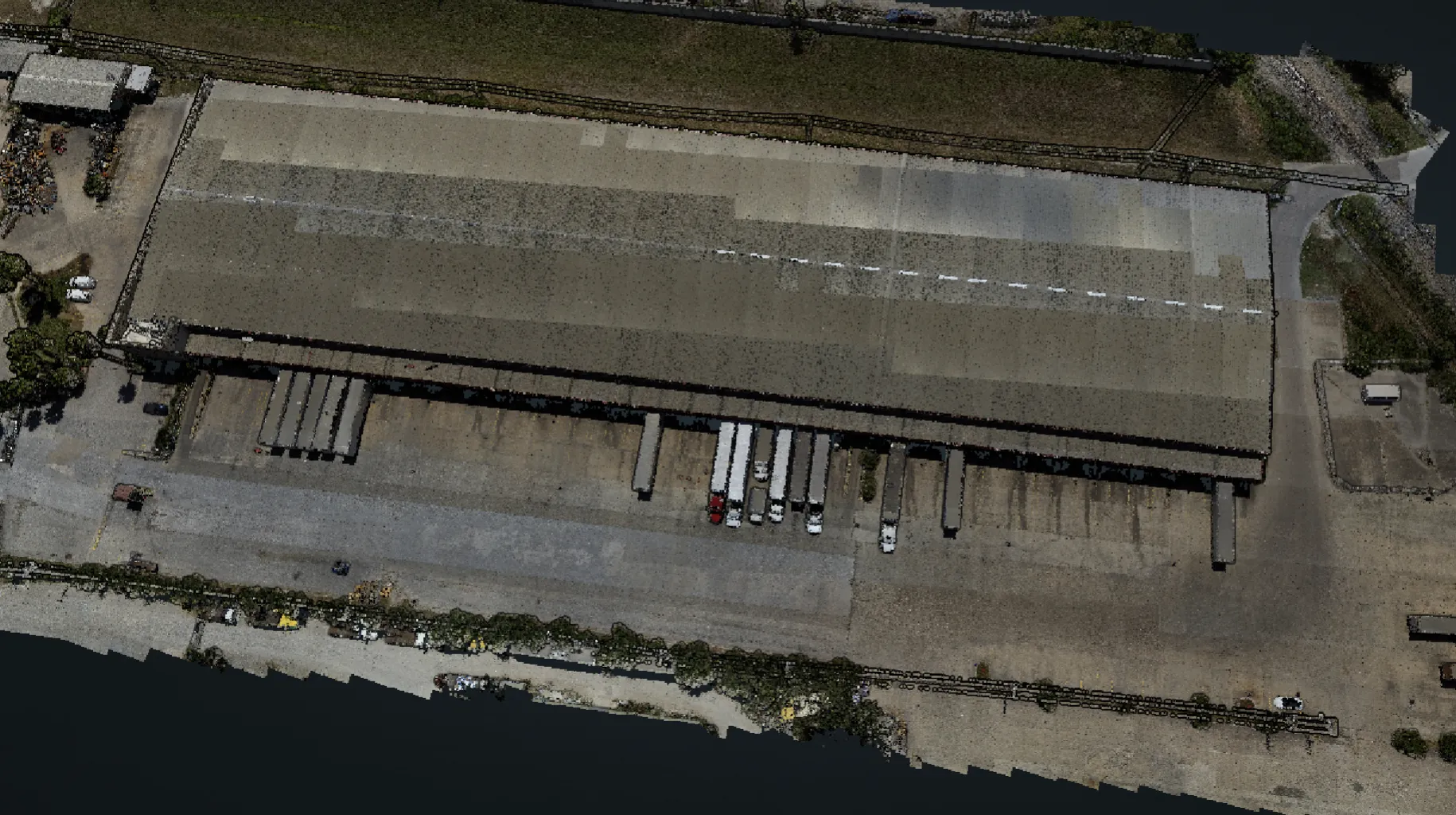
RGB-colorized LiDAR point cloud of the Loera Brokerage warehouse, viewed from above: loading docks with trailers along the south face and the surrounding yard.

Loera Brokerage Warehouse

LiDAR and photogrammetry mapping

Property assessment of a brokerage warehouse site.

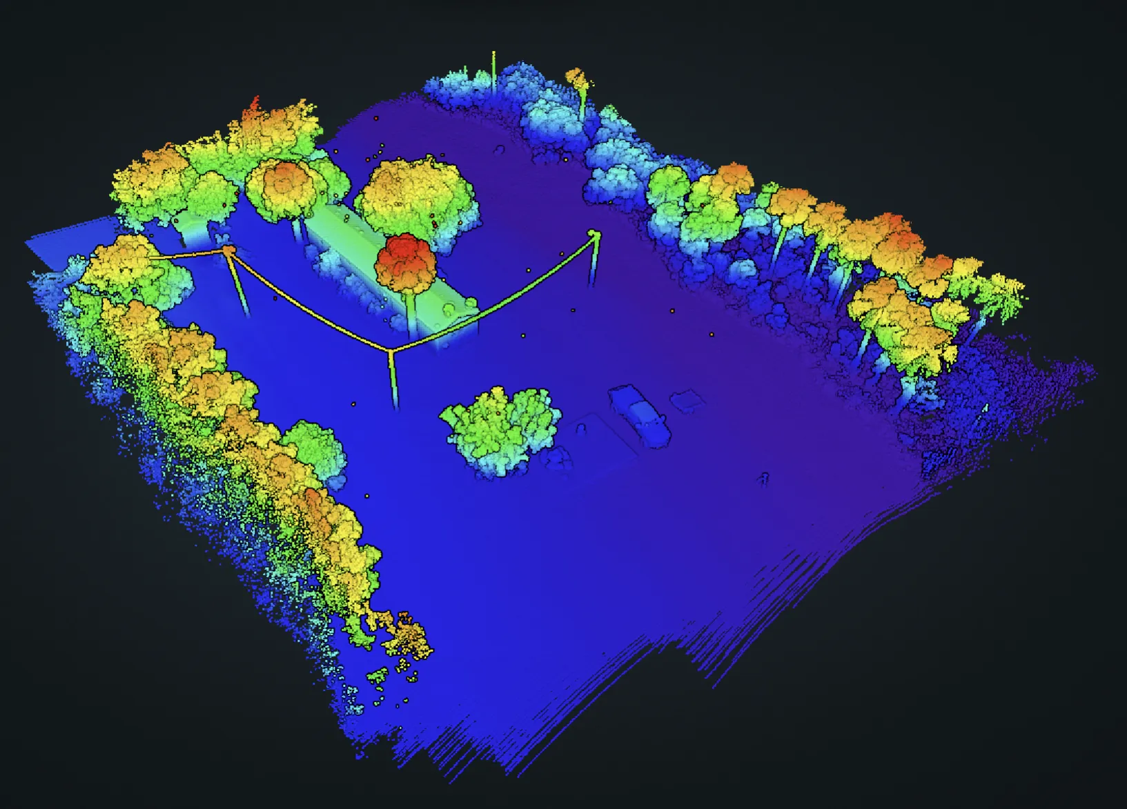
Elevation-colorized LiDAR point cloud of the VLS Construction site: tree lines and structures rendered in a viridis height ramp over level ground.

VLS Construction

LiDAR and RGB capture · Brownsville, TX

Accurate site conditions delivered ahead of the design phase.

RGB-colorized point cloud of the elevated railroad embankment: track and ballast running between tree cover with the adjacent right-of-way.

Aerial Intelligence Firm

LiDAR and photogrammetry

Terrain analysis used to evaluate flood risk along an elevated railroad embankment.

5miles of track

View deliverable

Send a location. Get a flight plan.

Share the site, timeline, and intended use. Axis Geospatial will confirm the right capture method, deliverables, and next steps for your Houston-area project.

FAA Part 107
[email protected]832-303-9757

Most project briefs answered within two business days.

600 Century Plaza Dr., Suite C-105 · Houston, TX 77073